Monitoring ozone in the atmosphere
The role of ozone in the atmosphere on life on Earth varies greatly depending on the altitude at which it is observed.
At high altitudes, stratospheric ozone absorbs much of the ultraviolet radiation and protects us from the harmful effects of the sun. The destruction of the ozone layer by chlorinated chemicals, commonly known as the “ozone hole”, has dramatic consequences for living beings and ecosystems.
Tropospheric ozone produced at ground level by road traffic and industrial activity and which can persist for several days in the lower layers of the atmosphere represents a significant air pollution that strongly affects human health and vegetation.
To analyse air pollution and thus tropospheric ozone, the AERIS cluster with the European research infrastructure for the observation of atmospheric composition from commercial aircraft IAGOS has been carrying out climatologies of ozone and carbon monoxide seen by aircraft since 1994. The flight paths cover a wide range of longitudes in the northern extratropics, extending from the west coast of North America (125° W) to the east coast of Asia (135° E) and more recently over the North Pacific Ocean. These climatologies are intended to be computed regularly as needed by users and are available on the IAGOS site managed by AERIS or also through the AERIS portal.


Satellite data offer a very efficient way to measure stratospheric ozone on a regular and global basis. In particular, the AERIS Cluster provides daily products from IASI instruments that probe the atmosphere in the thermal infrared.
However, it is much more difficult to invert ozone in the lower atmosphere from space. To understand and analyse ozone pollution, AERIS offers original products combining space-based observations in the thermal infrared and ultraviolet.
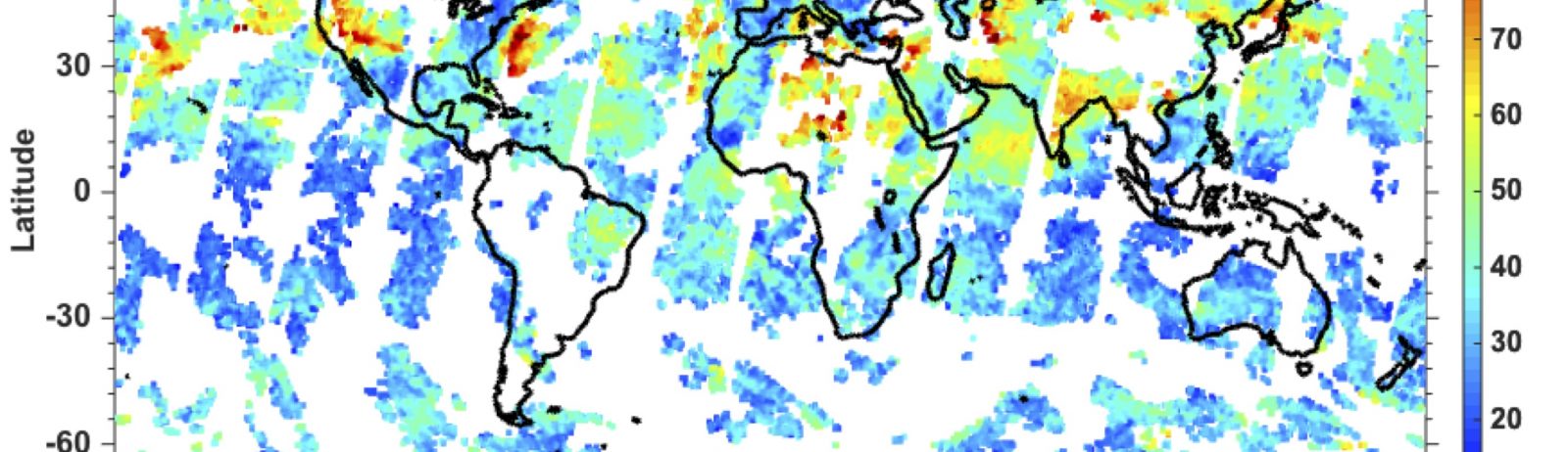
The IASI+GOME2 product allows multispectral observation of ozone in the lower troposphere and above based on the synergy of thermal infrared measurements from IASI and ultraviolet measurements from GOME-2. IASI+GOME2 has enabled the first satellite observation of the horizontal distribution of ozone pollution plumes below 3 km altitude. This unique approach was developed at the LISA laboratory (Laboratoire Interuniversitaire des Systèmes Atmosphériques), in collaboration with the Harvard-Smithonian Center for Astrophysics (USA), the Karlsruhe Institut für Technologie (Germany) and the Chinese Academy of Sciences.
Global IASI+GOME2 data are routinely produced by the AERIS ESPRI Atmospheric Data Centre. The development, validation and exploitation of the IASI+GOME2 approach are currently supported by the Centre National des Etudes Spatiales (CNES), the Université Paris Est Créteil (UPEC) and the Centre National de Recherche Scientifique (CNRS).