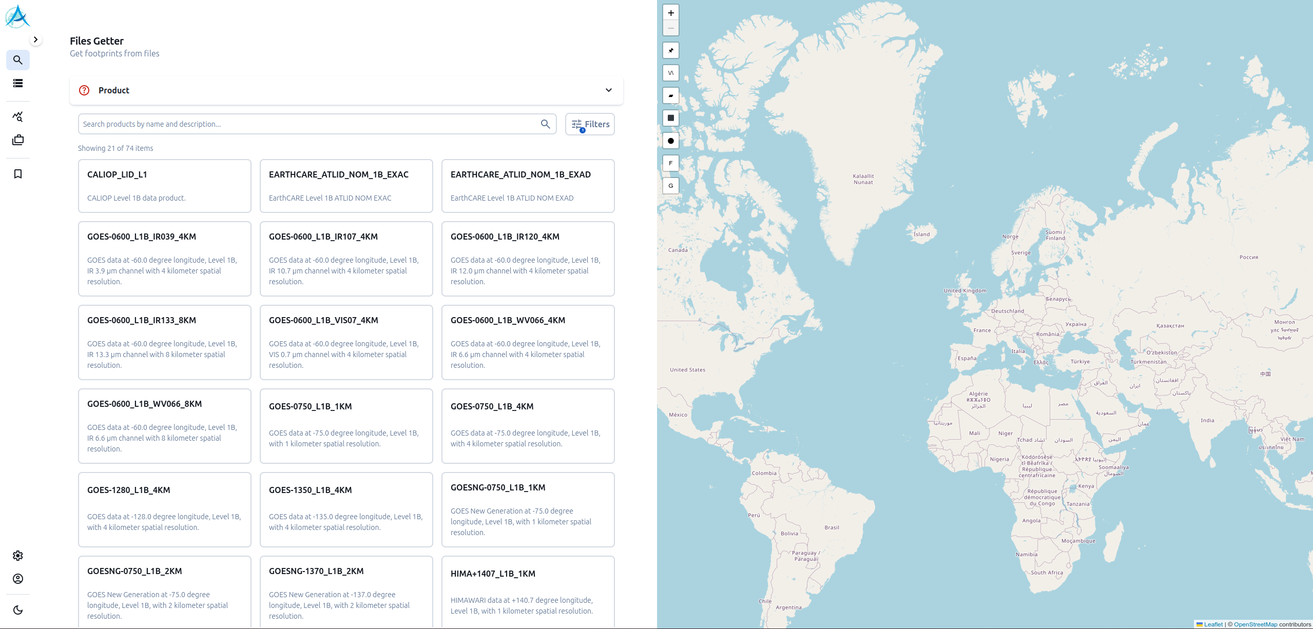
A new co-location/extraction tool is available in AERIS/ICARE DataViz
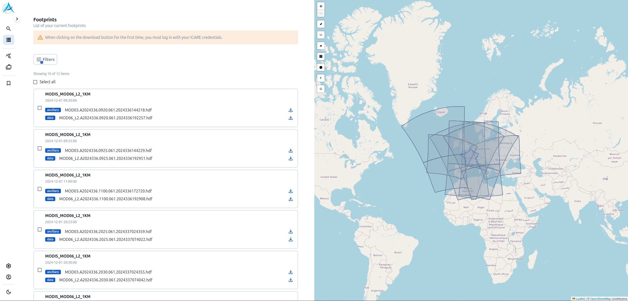
The co-location tool enables users to identify files of satellite products or extract data
or extract data corresponding to arbitrary spatio-temporal criteria.
criteria.
This interface makes calls to the AERIS/ICARE Daalia REST API, available at the following address
https://dataviz.icare.univ-lille.fr/daalia/ (see ‘Colocation’ section).
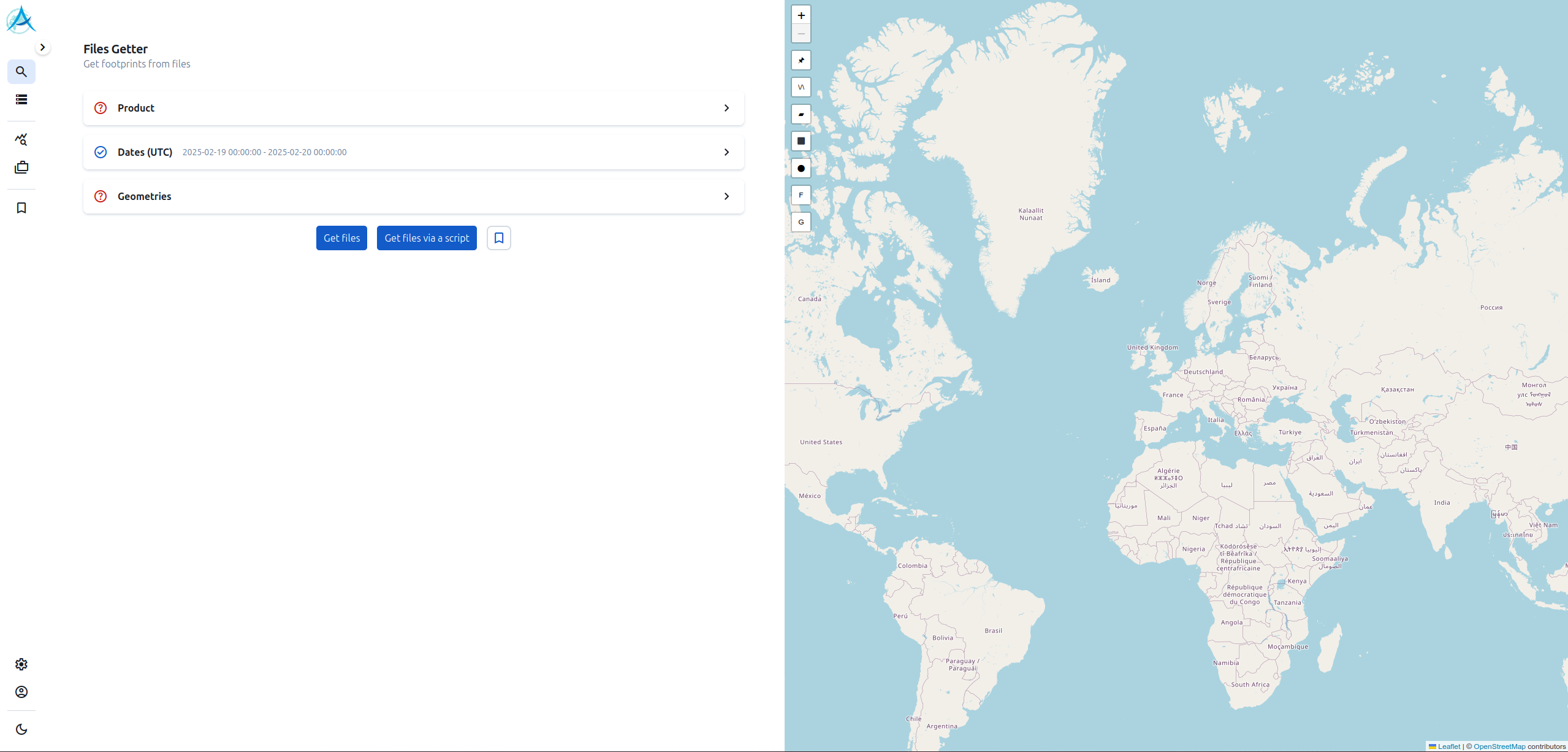
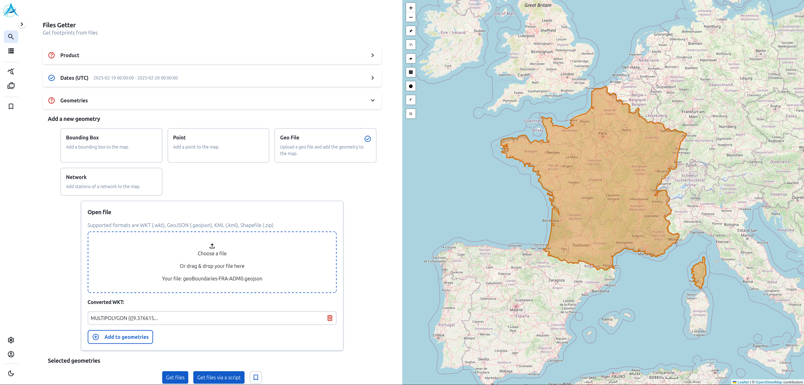
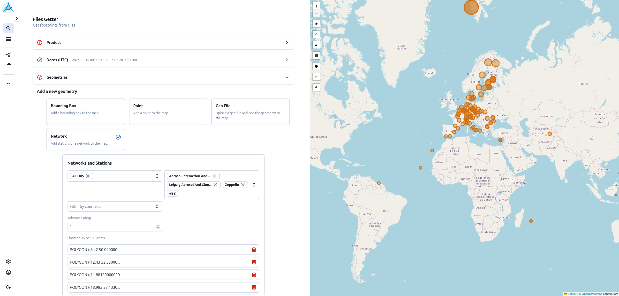
The spatial criteria are based on different geometries supplied by the user:
- Region around a coordinate point (latitude, longitude) with a tolerance radius
- Area delimited by minimum and maximum coordinates (latitude, longitude)
- Geometry file in WKT, GeoJSON, KML or Shapefile format (e.g. the borders of a country)
- Region around stations belonging to a network supported by the tool (e.g. AERONET)
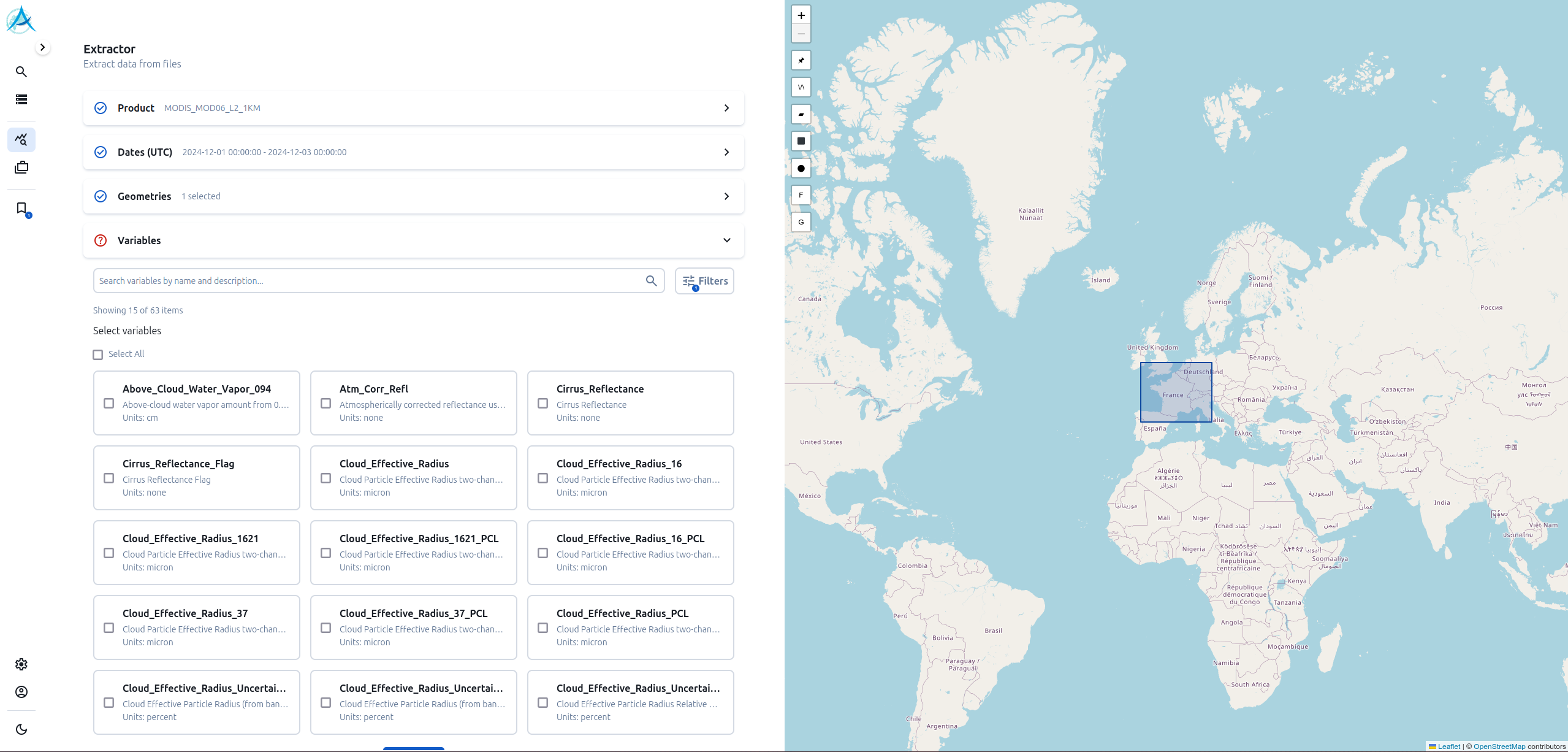
The tool’s functionalities include
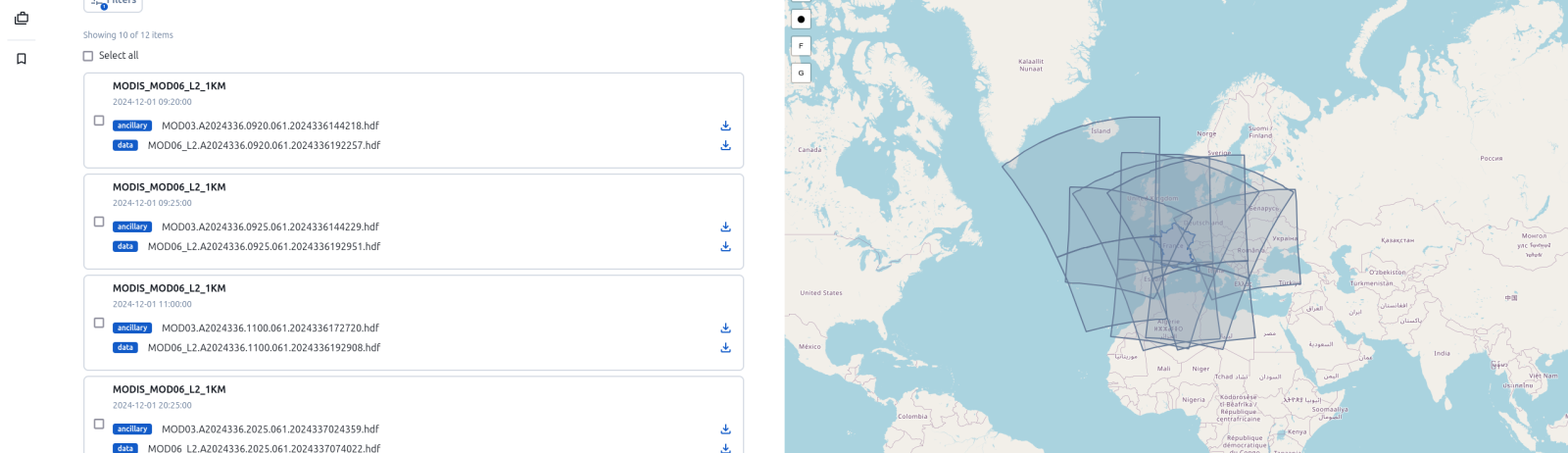
- to return a list of files whose geographical footprint intersects the geometries specified by the user ;
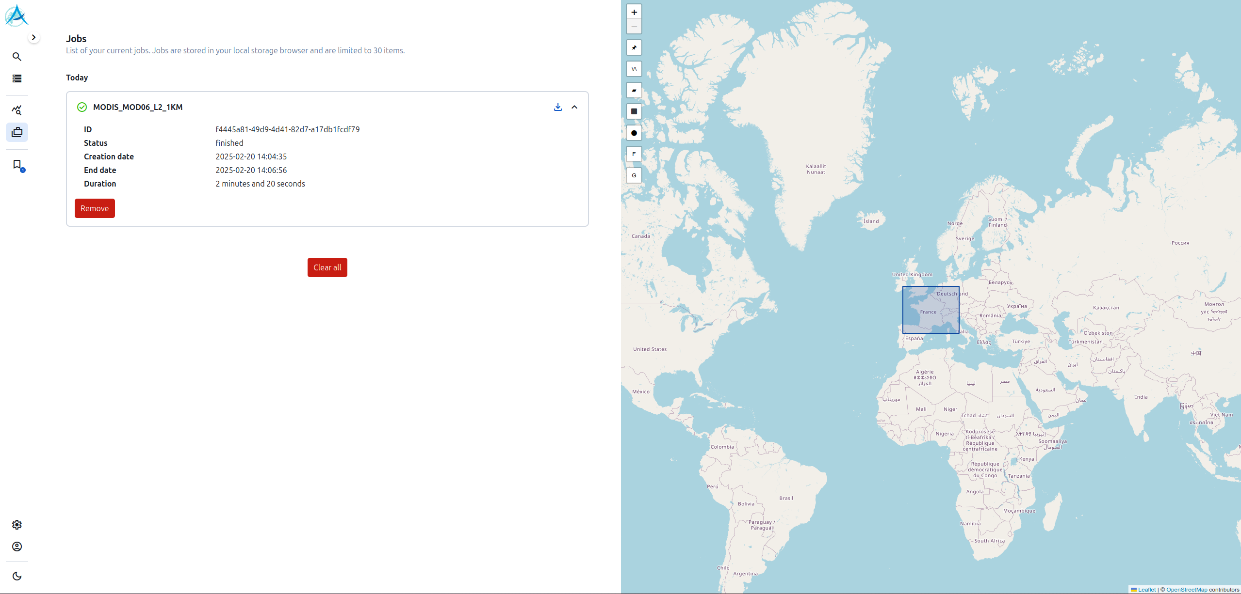
- extract the variables of interest from all these files and return a single file in netCDF format containing all the extracted data.
These extractions, which are often time-consuming, are launched in the form of jobs on the AERIS/ICARE servers. Once the job has been completed, the file is ready to be downloaded.
Note: In order to perform extractions, the user must identify himself via the AERIS SSO.
The co-location tool supports a large number of products from the AERIS/ICARE archive.
These products are derived from instruments onboard geostationary and defiling satellites.
satellites, such as :
- SEVIRI (MSG)
- TROPOMI (Sentinel-5P)
- ABI (GOES)
- AHI (Himawari)
- MODIS (Aqua/Terra)
A practical example of the use of the co-location tool is the comparison of data from ground-based instruments with data from instruments on board satellites.
If you have any comments or suggestions, please contact the AERIS/ICARE Data and Services Centre at
icare-contact@univ-lille.fr