Discover the new iAERUS-GEO/SEVIRI product
AERIS now offers the iAERUS-GEO/SEVIRI product, which enables the monitoring of aerosols in the atmosphere using observations from the Meteosat Second Generation (MSG) geostationary satellite, operated by EUMETSAT. The data are available from 1 July 2014 to the present day.
This product is the result of a collaboration between the National Centre for Meteorological Research (CNRM), Météo-France/CNRS and the AERIS/ICARE data centre, with the support of EUMETSAT.
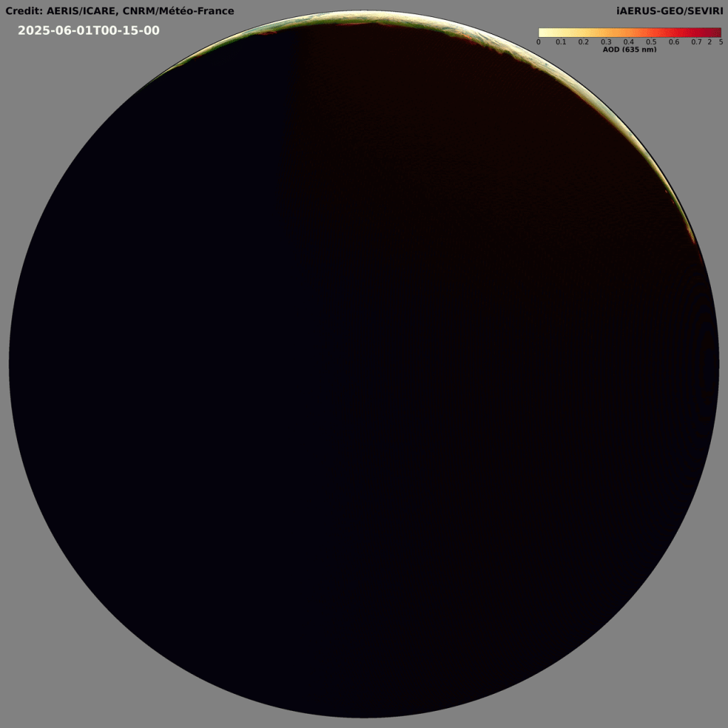
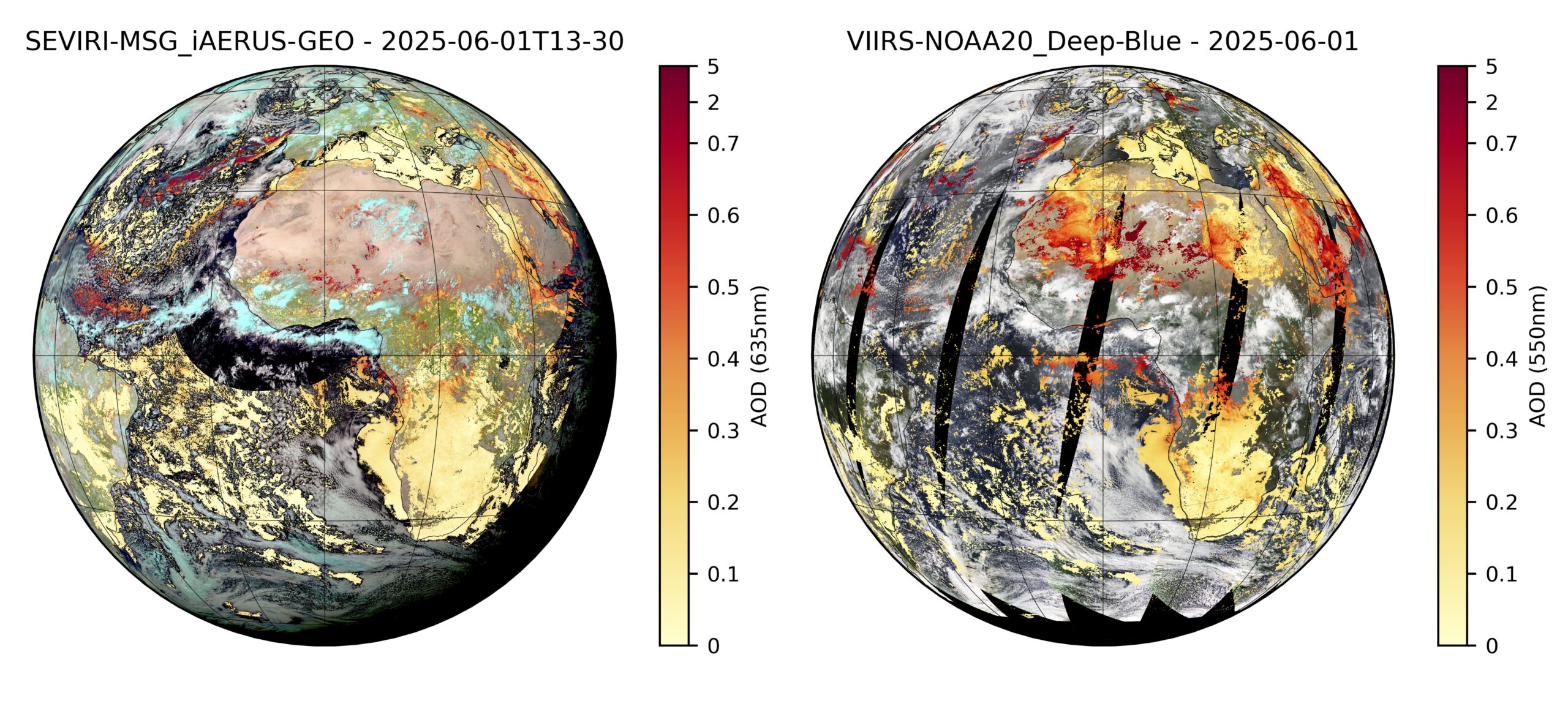
Using the SEVIRI instrument on board the MSG satellites, iAERUS-GEO provides maps of aerosol optical depth (AOD) every 15 minutes. These observations are made only during daylight hours, when there are no clouds, over both continents and oceans.
Why monitor aerosols?
Aerosols are very fine particles suspended in the air. They can originate from numerous natural or human sources: desert dust, smoke from fires, industrial pollution, sea spray, etc.
These particles play an important role in several areas:
- weather forecasting;
- climate research;
- air quality monitoring;
- civil aviation safety.
Their distribution in the atmosphere changes rapidly throughout the day and varies significantly from one region to another. Geostationary satellites are therefore a particularly valuable tool for continuously monitoring these phenomena, especially during events such as forest fires, where smoke can travel very long distances.
The most commonly used indicator for measuring the quantity of aerosols in the atmosphere is AOD (Aerosol Optical Depth). The higher this value, the greater the concentration of particles in the air.
How does iAERUS-GEO work?
The iAERUS-GEO algorithm, developed by the CNRM, uses observations from the SEVIRI instrument to estimate the AOD at a wavelength of 635 nm every 15 minutes.
To correctly distinguish the effect of aerosols from that of the Earth’s surface, the algorithm also characterises the way in which the ground reflects sunlight. This step is essential for obtaining reliable estimates.
The processing is based on a physical model simulating the propagation of light in the atmosphere, as well as on a precise description of the optical properties of aerosols. An optimal estimation method is then used to calculate AOD throughout the day, whilst the surface reflectance characteristics are updated daily.
Validated and reliable results
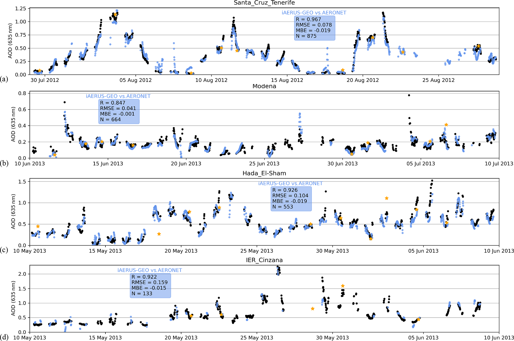
The performance of the iAERUS-GEO product has been evaluated by comparing it with other benchmark satellite products and with ground-based measurements. These comparisons show that the estimates obtained are accurate and robust, making it a valuable tool for monitoring aerosols at high temporal resolution.
To find out more about the algorithm and its scientific validation, please refer to the reference publication associated with the product.
To find out more and access the data:
https://www.icare.univ-lille.fr/projects/user-driven-projects/iaerus-geo/
https://www.icare.univ-lille.fr/projects/user-driven-projects/iaerus-geo/
References:
For further information regarding access to the products, registration with AERIS/ICARE or any technical enquiries, please contact icare-contact@univ-lille.fr. For any scientific enquiries regarding the iAERUS-GEO products, please contact Xavier Ceamanos (Principal Researcher at CNRM/MF).
[1] Ceamanos, X., Coopman, Q., George, M. et al. Remote sensing and model analysis of biomass burning smoke transported across the Atlantic during the 2020 Western US wildfire season. Sci Rep 13, 16014 (2023). https://doi.org/10.1038/s41598-023-39312-1
[2] Ceamanos, X., Six, B., Moparthy, S., Carrer, D., Georgeot, A., Gasteiger, J., Riedi, J., Attié, J.-L., Lyapustin, A., and Katsev, I.: Instantaneous aerosol and surface retrieval using satellites in geostationary orbit (iAERUS-GEO) – estimation of 15 min aerosol optical depth from MSG/SEVIRI and evaluation with reference data, Atmos. Meas. Tech., 16, 2575–2599, https://doi.org/10.5194/amt-16-2575-2023, 2023
[3] Escribano, J., Bozzo, A., Dubuisson, P., Flemming, J., Hogan, R. J., C.-Labonnote, L., and Boucher, O.: A benchmark for testing the accuracy and computational cost of shortwave top-of-atmosphere reflectance calculations in clear-sky aerosol-laden atmospheres, Geosci. Model Dev., 12, 805–827, https://doi.org/10.5194/gmd-12-805-2019, 2019.
[4] Holmlund, K., and Coauthors, 2021: Meteosat Third Generation (MTG): Continuation and Innovation of Observations from Geostationary Orbit. Bull. Amer. Meteor. Soc., 102, E990–E1015, https://doi.org/10.1175/BAMS-D-19-0304.1.
[5] Georgeot, A., Ceamanos, X., Attié, J.-L., Juncu, D., Gasteiger, J., and Compiègne, M.: Towards improved retrieval of aerosol properties from the geostationary orbit with the new Meteosat Third Generation-Imager satellite, Atmos. Meas. Tech., 18, 4665–4693, https://doi.org/10.5194/amt-18-4665-2025, 2025.